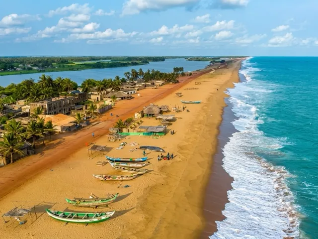
La plage de Grand-Popo
©

Grand-Popo Beach

|

Kulttuurinavigaattori / CC BY-SA 4.0 — Wikimedia Commons

The riches of the coastline

Grand-Popo and the Bouche du Roy

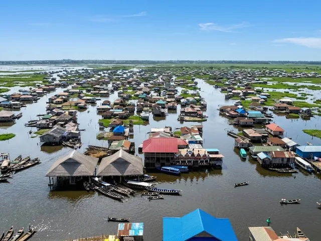
Benin stretches from the Gulf of Guinea to the Atacora Hills. From the royal palaces of Abomey to the lakeside town of Ganvié and the World Heritage-listed parks in the north, the country boasts a diversity rarely found in West Africa within its compact territory.

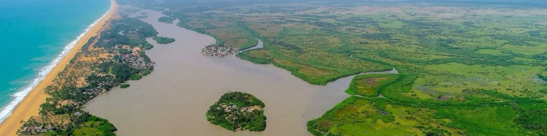
At the far south-western tip of the coastline, an old trading post eroded by the sea, a lagoon fringed with mangroves, and the mouth of the Mono, where the river forces its way out to the Atlantic.

A jetty being reclaimed by the sea

Grand-Popo stretches between the ocean and the lower Mono River, some 85 km from Cotonou via the RNIE 1, the road to Lomé. The name actually refers to the land of the Xwla, a people of fishermen and salt-makers living along the coastal strip. Local tradition links these communities to the Aja migrations from Tado. From the 17th century onwards, the site became a trading post with European ships, then a commercial centre, and finally an administrative capital during the colonial era.

What we come to see today is partly a reflection of this troubled history: colonial buildings, now in ruins or repurposed; the homes of the Aguda families – Afro-Brazilians who returned from Brazil in the 19th century; and tombs and façades with cornices. Part of the old town has been swept away by the ocean.

Coastal erosion is not just a figure of speech here. It is being measured. Topographical surveys carried out between 2011 and 2014 by the IRHOB, the University of Abomey-Calavi and the IRD show a retreat of around 5 metres per year between Hillacondji and Agoué, whilst the Ayiguénou–Grand-Popo sector appeared stable at the time. Other studies suggest rates of 10 to 15 metres per year in some parts of the Beninese coastline. The phenomenon varies significantly from one coastal segment to another; the causes put forward include dams on the Mono River, port structures, sand extraction and rising sea levels.

La Bouche du Roy, by canoe

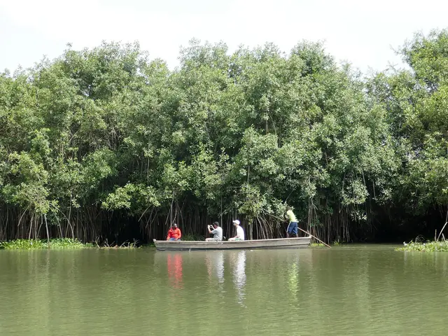
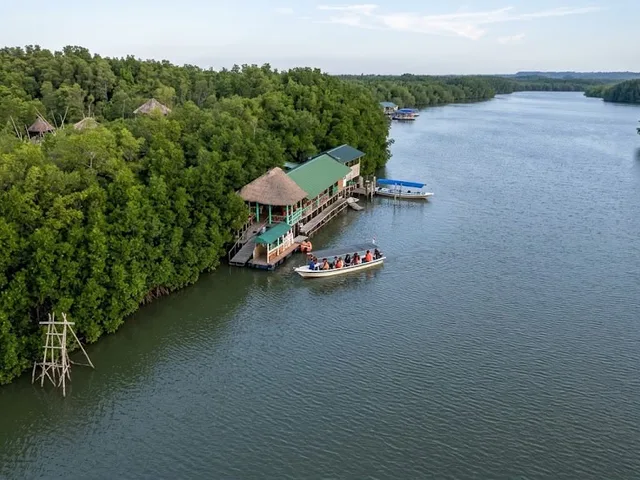
About ten kilometres east of the village, the Mono River, the lagoon and Lake Ahémés converge before cutting through the sandbar: this is the Bouche du Roy. It can be reached by pirogue, usually from the district of Avlo. The journey takes you through the mangrove swamp, past sandbanks and small islets where waterbirds, including migratory species, rest.

The site forms part of the Mono Delta Transboundary Biosphere Reserve, recognised by UNESCO in 2017 and shared with Togo. At a local level, a community-based biodiversity conservation area has been established in collaboration with the villages and eco-guards.

Four species of sea turtle are found in Benin’s waters; on the beaches, it is the olive ridley and the leatherback turtles that lay their eggs. The periods given vary depending on the source: local monitoring covers August to November, whilst published studies extend the season from August to March, with peaks in November and January. A simple rule: never approach a female laying eggs, a nest or hatchlings without an eco-guard. Lights and camera flashes can cause a turtle to abandon its nesting attempt.

The beach, the seine net and the currents

In the morning, on the beach, the crews haul in the seine: two long lines of men pull the net from the sand, in time to a song. It’s the best time of day to be there.

As for the ocean, it is not suitable for swimming. The Beninese coast is exposed to long swells from the South Atlantic, a strong west-to-east coastal drift and rip currents that pull swimmers out to sea. The beach slope is steep, the beaches are unsupervised and drownings occur every year. Stay within the surf zone, and never go in alone. If caught in a current, do not swim against it: let yourself be carried along, swim parallel to the shore, then make your way back.

La plage de Grand-Popo
©

Grand-Popo Beach

|

Kulttuurinavigaattori / CC BY-SA 4.0 — Wikimedia Commons

La mangrove du fleuve Mono
©

The Mono River mangrove forest

|

Wikimedia Commons

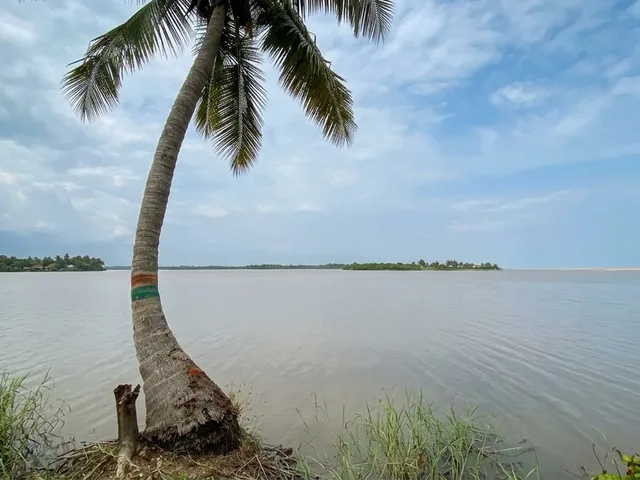
Le lac Ahémé
©

Ahémé Lake

|

Rachad Sanoussi / CC BY-SA 4.0 — Wikimedia Commons

In practice

  • Grand-Popo municipality, Mono department, south-west Benin, on the border with Togo
  • It is about 85 km from Cotonou via the RNIE 1, through Ouidah and Comè – a journey of one and a half to two hours by car. La Bouche du Roy can be reached by pirogue; boarding is on the Avlo side.
  • Allow half a day for the trip to La Bouche du Roy; add two nights to include the village and the beaches
  • Best time to visit: November to February, the dry season, when the sea is calmer and turtles come ashore to lay their eggs; August and September for the short dry season
  • Good to know: tourist activities at the site are regulated by a local by-law. Please book through a registered guide and the visitor centre, not through a tout on the beach.